Navionics Platinum+ NPUS006R - U.S. South
Navionics Platinum+ NPUS006R - U.S. South
Couldn't load pickup availability
Get the world’s No. 1 choice in marine mapping - with the best, most up-to-date Navionics Platinum+ cartography on your compatible chartplotter.
For offshore or inland waters, this all-in-one solution offers detail-rich integrated mapping of coastal waters, lakes, rivers and more. Get SonarChart™ 1’ (0.5 meter) HD bathymetry maps, advanced features such as dock-to-dock route guidance technology, live mapping and Plotter Sync to provide wireless access to daily updates.
The Navionics Chart Installer software also ensures the freshest chart data every time out. Navionics dock-to-dock route guidance solutions give you a suggested path to follow through channels, inlets, marina entrances and more. Multiple shading options aid in shallow water navigation and make it easy to highlight a target depth range for the best fishing spots.
Navionics Platinum+™ charts include all the content of Navionics®+ cartography, with integrated offshore and inland mapping, 42,000+ lakes and additional viewing options for relief shading, satellite imagery with SonarChart shading overlay, 3D perspective view, aerial photos, and more.
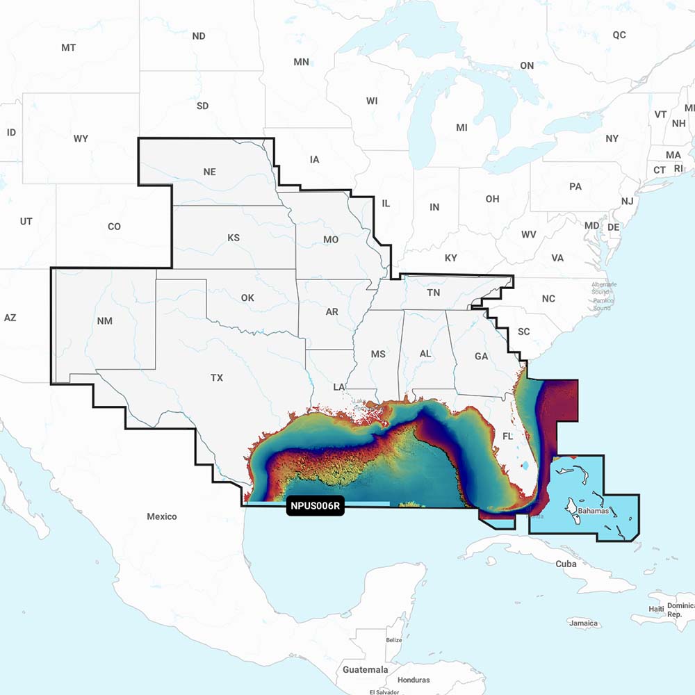
Chart Code - NPUS006R
Coverage Area:
Coverage of the lakes, rivers and coasts of Alabama, Arkansas, Florida, Georgia, Kansas, Louisiana, Mississippi, Missouri, Nebraska, New Mexico, Oklahoma, Tennessee, and Texas. Coastal coverage of the Gulf of Mexico, the Atlantic coasts of Florida and Georgia, the Bahamas and the Florida Keys are also included.
Features: